I took the Fly out to the Columbia Gorge, a stunning natural marvel of rocky cliffs overlooking the Columbia River, dotted with cascading waterfalls. It’s about 30 minutes east of downtown Portland, easy to access along back roads and then onto the Historic Columbia River Highway. Once on the highway (which is really a winding two lane forested road, max speed about 45 on the straightaways), tourists and locals alike stop to gawk at massive waterfalls and hike wooded trails to scenic views of the Gorge.
The Fly handled marvelously throughout the trip, taking the corners in stride and giving me enough power to make the ride more fun than I’ve ever had on two wheels.
Camera: My Samsung Galaxy S6 phone. Does a fine job unless you want a decent photo zoomed in. I’m going to pick up a good quality point and shoot digital camera for these trips in the future.
Here's the route map:
Here's the route map:
First stop: Vista House, an historic observatory at Crown Point.
The view from Vista House.
A strangely off-center photo of Vista House itself.
A strangely off-center scooterist.
Latourell Falls, the first waterfall on the route.
Here's some info about Latourell Falls.
Latourell Falls up close.
Bridal Veil viewpoint.
If you're going to have a blog about riding a scooter, you have to have an artistic helmet shot in there somewhere, right?
View from Bridal Veil.
Put an origami bird on it.
The crown jewel of any trip to the Gorge - Multnomah Falls.
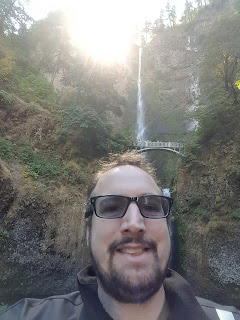
Multnomah Falls selfie!
Vista House on the way back, seen from the Women's Forum Historic Viewpoint.
Last stop - The Women's Forum Historic Viewpoint.


No comments:
Post a Comment